CLI
Script catalogs and manifest-as-code from your terminal. Installs the geolens command.
pip install geolens-cli Search, map builder, data ingestion, raster/VRT, AI chat, and role-based access control. GeoLens is a complete open-source GIS data catalog with OGC API support.
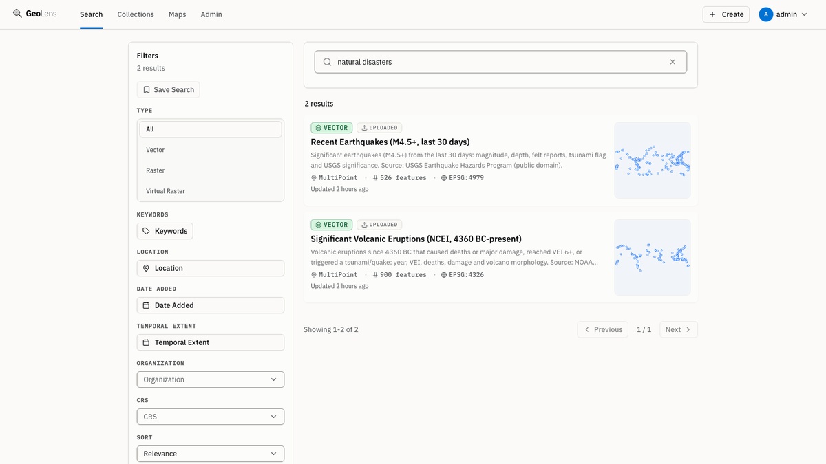
Search and discover
Search across your entire GeoLens catalog by name and description. When semantic search is enabled and your catalog is indexed, you can also search by semantic meaning. Filter by geometry type (vector, raster, or table) and preview datasets on a map before you export.
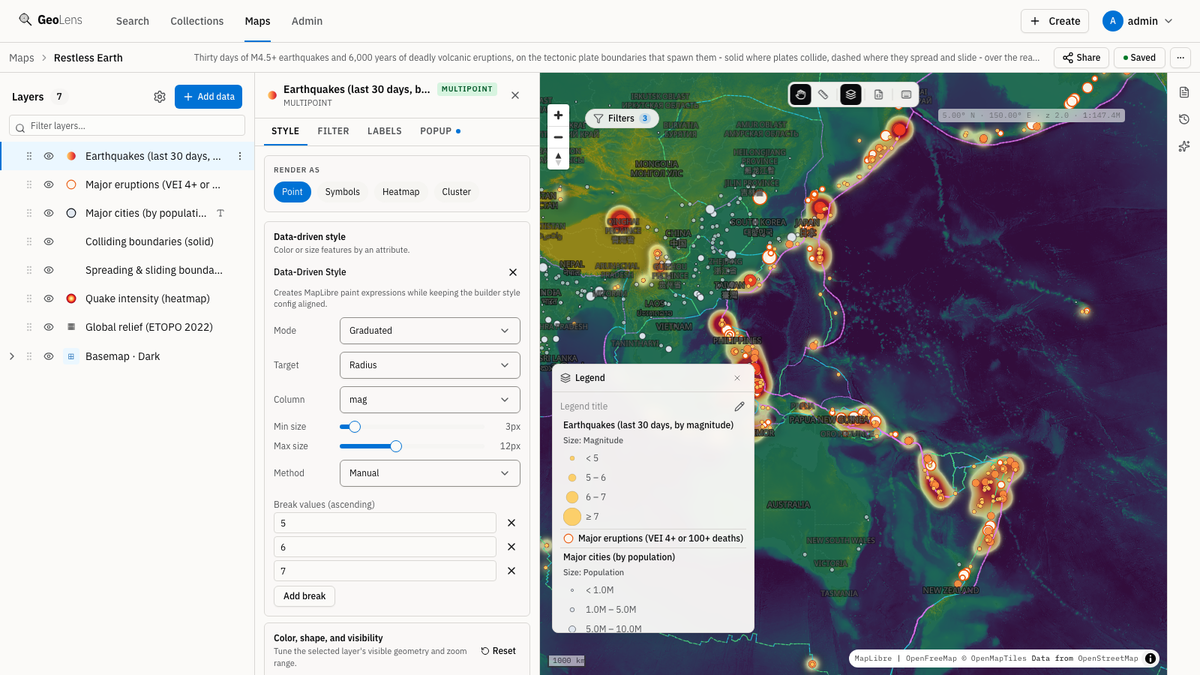
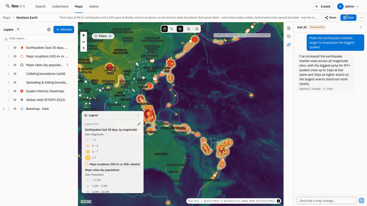
Create and share maps
Combine vector and raster datasets from your catalog with point-and-click layer controls. Pick basemaps, reorder layers, adjust styling, and publish a shareable map URL without writing SQL or leaving the browser. Run PostGIS analysis on any layer in the map and save the output back to the catalog.
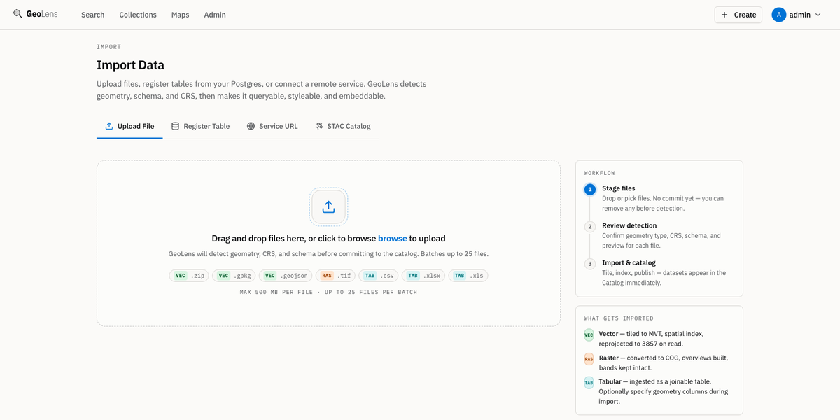
Ingest any format
Drop a Shapefile, GeoPackage, GeoJSON, GeoParquet, CSV, XLSX, or GeoTIFF and GeoLens handles validation, CRS inspection, column sampling, and catalog indexing automatically. Metadata fills in from the file; you just click publish.
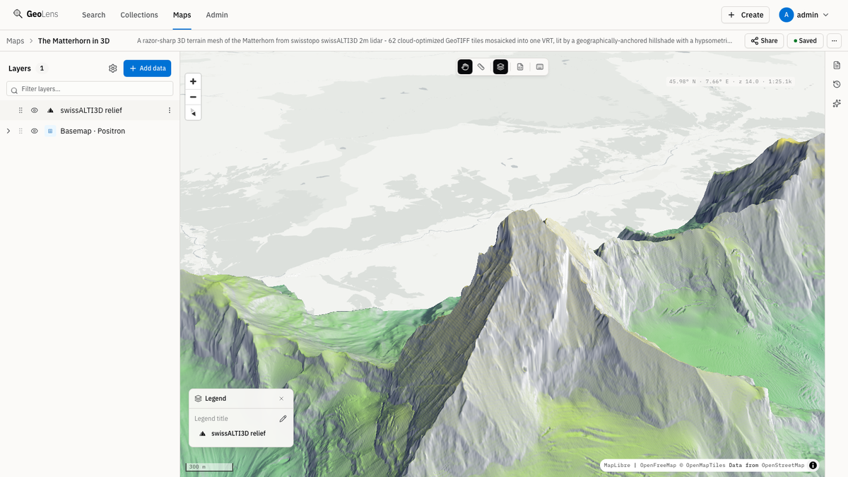
Raster and VRT mosaics
Stitch multiple Cloud-Optimized GeoTIFFs into a single VRT mosaic, then serve raster tiles via Titiler, with band selection, colormaps, and min/max stretch controls, plus a direct COG download from the dataset page.
AI-assisted exploration
Configure an OpenAI-compatible endpoint or Anthropic key and chat with your GeoLens catalog. Ask which datasets cover a region, request a filtered layer, or inspect spatial relationships in natural language.
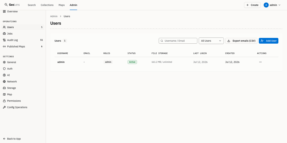
Role-based access control
Assign roles, approve or reject users, and scope dataset visibility per dataset. GeoLens ships with admin, editor, and viewer roles plus JWT-based sessions and OAuth (Google, Microsoft, OIDC).
Programmability
Everything you do in the UI is scriptable. Drive catalogs, datasets, and maps from the command line or your own code: define a catalog as a manifest, commit it to version control, and apply it in CI. The CLI and SDKs talk to the same open APIs.
Script catalogs and manifest-as-code from your terminal. Installs the geolens command.
pip install geolens-cli Build pipelines and integrations in Python against the full GeoLens API.
pip install geolens Embed GeoLens in JavaScript and TypeScript apps with a typed client.
npm install @geolens/sdk Point Claude Code, Cursor, or Codex at your catalog: five read-only tools for dataset search, schemas, features, and maps.
pip install geolens-mcp GeoParquet in, GeoParquet out: export any vector dataset and query it straight from DuckDB.
INSTALL spatial; LOAD spatial;
SELECT * FROM 'my-dataset.parquet' LIMIT 10;Standards support
GeoLens serves OGC API Features and Records with CQL2, plus STAC and DCAT 3 metadata, so every dataset is reachable by standards-aware clients and your catalog travels in open formats. The Features and Records APIs return their advertised classes at /conformance.
Read and filter geospatial features by bounding box. Part 1 (Core); CQL2 filtering is available on the catalog Records collection.
Discover datasets and records via OGC-standard catalog queries: browse collections, filter by metadata, and retrieve individual records as JSON.
Run the public installer, log in, and upload your first dataset. It lands on your own infrastructure, not ours. The Quickstart also covers the source checkout path.
curl -fsSL https://getgeolens.com/install.sh | sh Or script it: automate GeoLens from the command line or your own code.